Volume of water required to fill the lake
Lake Bolac volume
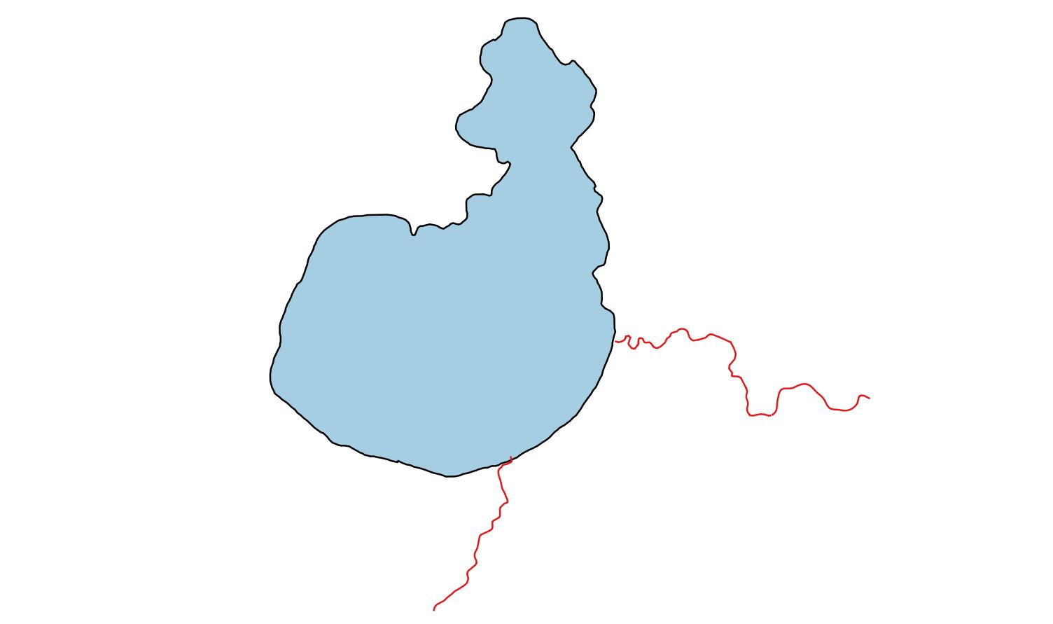
Lake Bolac covers an area slightly larger than 1400 ha. It is approximately 2 m deep when full. This equates to a volume of water when full of around 28000 megalitres (ML).
| Area | 1 400 ha |
| Depth | 2 m |
| Volume | 28 000 ML |
Metric measures for large volumes
We are familiar with using litres as a measure to describe the volumes of everyday items such as milk or fuel. We need a bigger scale when calculating large volumes such as when describing the holding capacity of a lake, or the amount of runoff in a catchment. Megalitres (ML) is the metric scale that is used. It has the advantage of being simple to calculate from two parameters; area and depth. ML is often derived from area measured in hectares or square kilometres, and depth, whether measured in millimetres or metres.
How big is a megalitre?
A megalitre is one million litres, or 1000 cubic metres. Here are several examples to help visualise what that volume would look like.
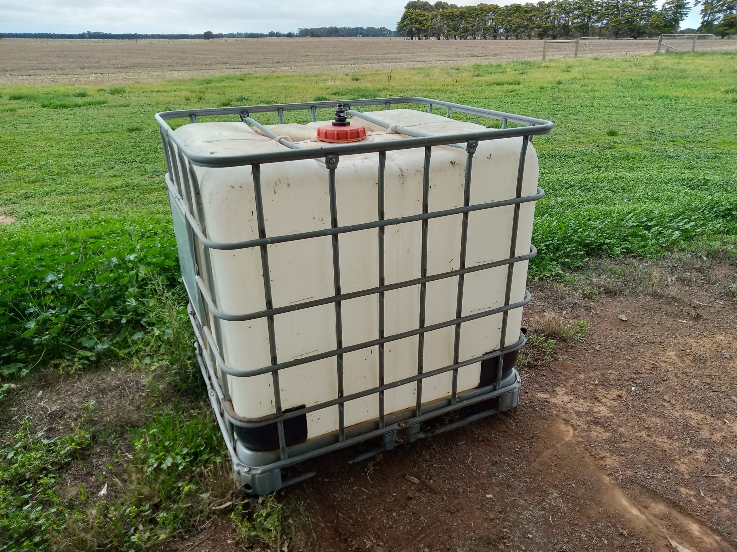
- IBC shuttles are used on farms for holding liquids such as spray chemicals. They hold 1000 L, which is equivalent to one cubic metre. One megalitre is equivalent to the volume of 1000 IBCs.
- Another example would be that a megalitre is similar to the volume of grain carried by four semi trailers.
- A megalitre of water spread over a hectare would have a depth of 10 cm. The equation is
100 m * 100 m * 0.1 m = 1000 m^3
Catchment runoff
Approximately 35 mm of runoff over the whole upstream catchment theoretically would be enough to fill Lake Bolac. The information here is a general guide only, to illustrate the scale of what it takes to fill a lake. The calculations are shown below.
Lake Bolac catchment area
The H11 and H12 catchments have a combined area of approximately 174000 ha. The effective runoff area is reduced because of internally draining wetlands and the lower section of H11 where runoff flows into Salt Creek. If the wetlands in general have their own small catchments, then the H11-H12 area that feeds Lake Bolac would be approximately 98 000 ha. The runoff from that area needed to fill the lake is 28 mm. The actual required could 25% greater, or closer to 35 mm, due to upstream wetlands and dams that also fill from the Fiery Creek.
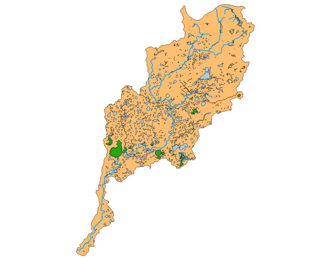
| Lake Bolac catchment area | 159 000 ha |
| less internally draining wetlands | |
| Wetland areas | 21 000 ha |
| Wetland effective catchment area (x2) | 40 000 ha |
| equals | |
| Net catchment area | 98 000 ha |
How much of the water in Lake Bolac originates from rain on the mountains?
Sometimes during wet years the rainfall can be quite high in the upper catchment, including the Mount Cole area north of the Western Highway. This can result in a rapid rise in the level of the Lake Bolac.
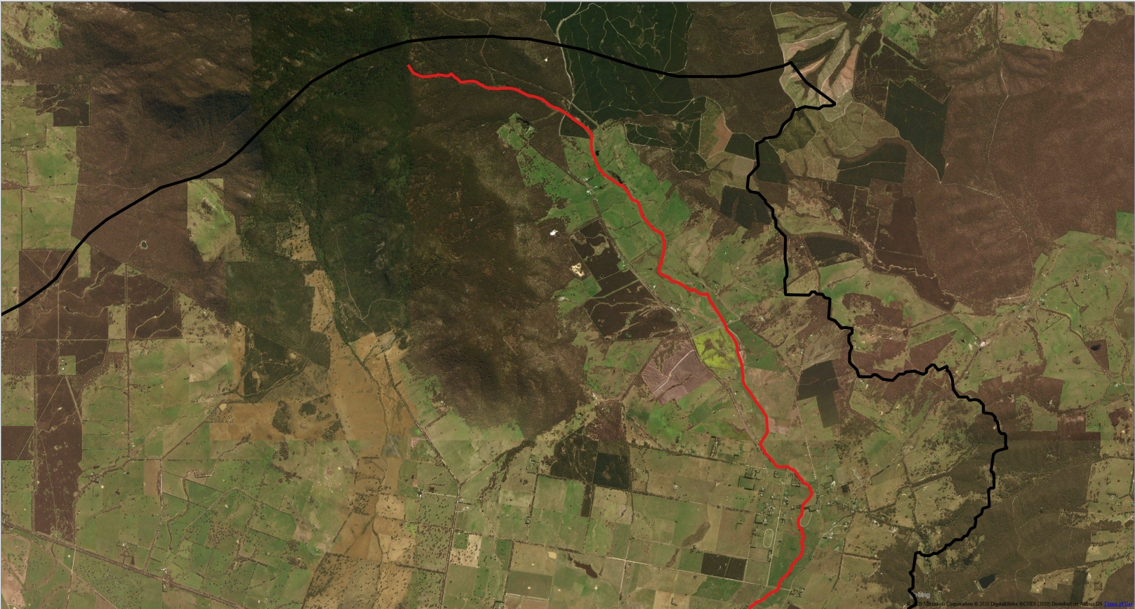
The mountain is steep by comparison with the surrounding plains, and so much of the rainfall can collect in the creek. However, the contribution to lake fill from this area might be of less importance than has been thought in the past. The area of mountains in the Fiery catchment is about 8400 ha, or about six times the area of the lake. This means that if 100 mm of runoff from the mountain flowed all the way to Lake Bolac, it would add about 600 mm to lake depth.
During dry, or average rainfall, years, the bed of the creek will need to be saturated before flow can continue downstream. A large influence on this will be the degree of soil saturation all the way down the catchment. And so for most years, rainfall and runoff across the whole catchment will have the greatest influence inflows into Lake Bolac.
What affects runoff?
Water flows over the soil surface when it rains heavily. This sounds simple, but the story about how much runoff will ocur is quite complicated. Some of the main drivers are:
-
- Rainfall intensity. Gentle rain is more likely to soak into the soil. The same amount of rain falling in a short time is more likely to run downhill.
- Soil moisture content. Wet soil that is saturated cannot absorb rainfall. Sometimes very dry soil can form a water resistant surface that is slow to become wet.
- Soil structure. Hard packed soil cannot absorb much water because there are few air spaces between the soil grains. Friable soil is able to store water without becoming saturated. The microscopic size distribution of pores between soil particles has a large influence on the rate that water can drain through soil.
- Soil chemistry. How much water a soil can absorb depends on its ratio of sand, silt and clay. Water can be held in the spaces between sand particles, whereas clay particles can also hold water internally. Soil elements such as calcium in lime or gypsum will promote soil structure, while sodium decreases structure.
What about evaporation?
In Australia, the amount of runoff that occurs during the year is quite sensitive to evaporation rates. In fact the annual evaporation rate for this part of Victoria is on a similar scale to annual average rainfall. A small increase in temperature combined with low humidity will dry moisture from the soil. This means that more rainfall is needed before there is runoff that can make its way to the waterways and creek.
Runoff variation in a land of drought and flooding rains
How much water has been coming down the Fiery Creek?
More detail about the flows in the Fiery Creek over the last 100 years is given in the Fiery Creek flows menu.
How much runoff has there been recently?
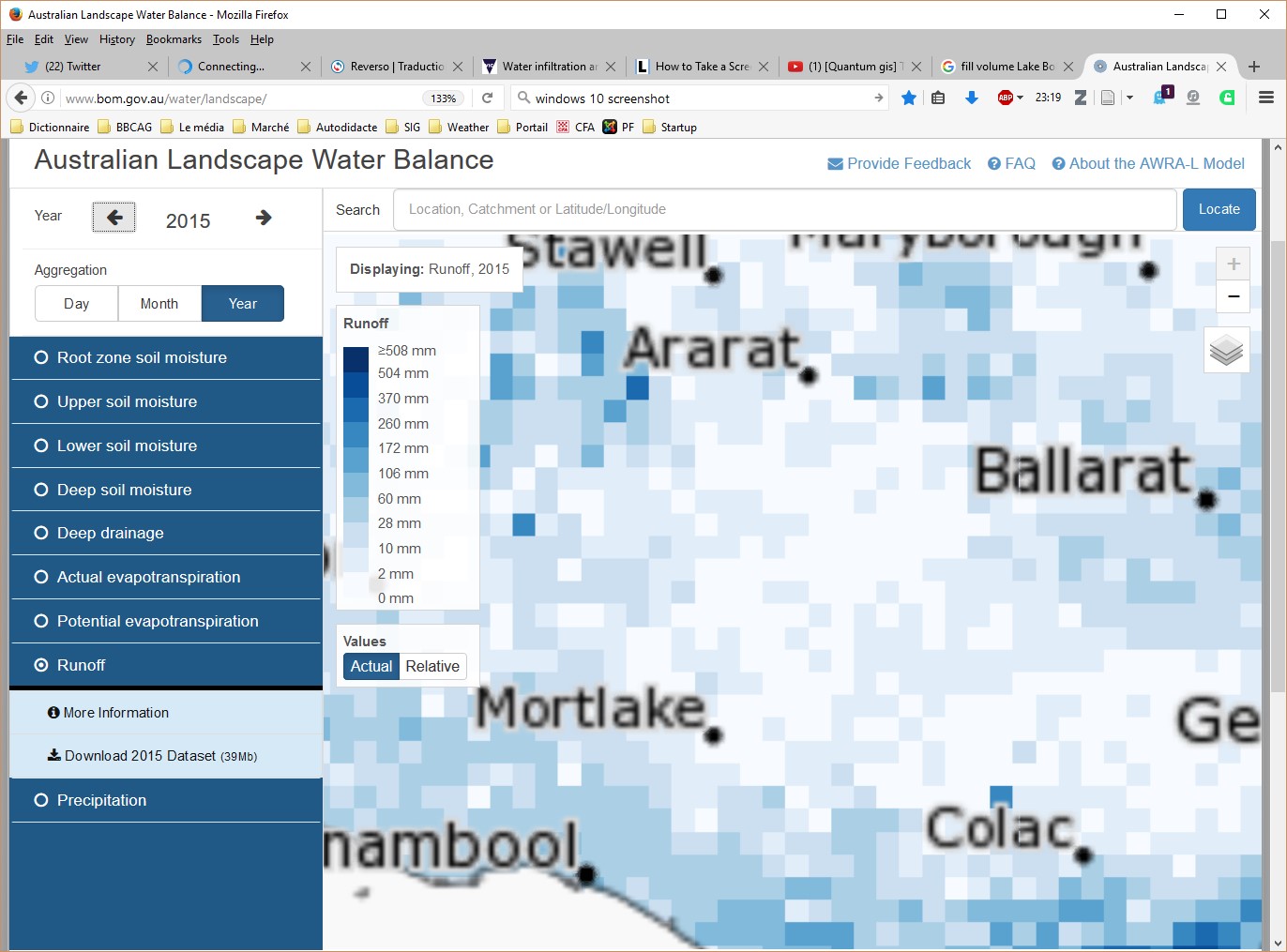
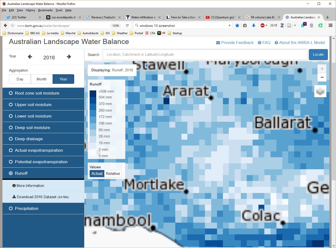
The Bureau of Meteorology has an interactive tool called the Landscape Water Balance that can be used to show calculated runoff across Australia. It can be used day, month or year periods within the last ten years on a 5 km grid scale. It has menus for a range of weather dependent characters, including for evaporation, soil moisture, calculated runoff and deep drainage.
The BOM calculated runoff values for 2016 are in the range of 10 to 60 mm for different sections of H11 H12 catchments. By comparison, their values are between 2 and 10 mm annual runoff for each of 2014 and 2015. This shows just how strongly that runoff is influenced by variations in seasonal weather conditions.
Which were the dry years?
Old and recent satellite data is being used to reconstruct how surface water has changed across the landscape over time. This map from Digital Earth Australia can be used to show estimates of which year had surface water visible for Lake Bolac since 1990. Once you click the 'Acknowledge' statement, then there is a play menu at the bottom left to start displaying the summer season surface water over the years. You can move the map to view different locations. The Digital Earth Australia website has more display options than is shown here.
Past weather
The Bureau of Meteorology has archived a wealth of historic weather records. Recent data for specific weather stations in Victoria can be accessed here.
Future outlook
Future climate and runoff in the H11 and H12 catchment regions
Average rainfall is projected to decrease over time in SW Victoria, especially during winter and spring, even though it is probable that extreme rainfall events will become more common (gov.au). This, combined with a high confidence of higher temperatures means that runoff is likely to decrease, especially in southern Victoria (Post et al., 2009). The degree of change from current conditions will be highly dependent on the actual CO2 levels that occur (Timball et al., 2016, Potter et al., 2015). Timball et al. also give an in depth description of climate trends, the drivers, and predictions for this region of Victoria.
Future water outlook for Lake Bolac
Climate change is expected to produce an overall increase in the frequency of drying events for Lake Bolac (Leahy et al. (2009). One reason is due to a decrease in runoff. Another is that Lake Bolac is large and shallow, which makes it sensitive to increased evaporation rates from its surface. This trend is expected to affect other Victorian lakes too, especially those in the north of the state. One of the adverse consequences is that lake salinity will be higher more often, which reduces the number of species that could persist there. More information about that impact on lake ecology can be found in the Lake as an ecosystem section.
References
gov.au (accessed 1 May 2020) Climate change in Australia. Projections for Australia's NRM regions. www.climatechangeinaustralia.gov.au
Leahy et al. (2010). Lakes in the Western District of Victoria and climate change. EPA Scientific Report 1359. (pdf)
Post et al. (2009). Future runoff projections (~2030) for SE Australia. South Eastern Australian Climate Initiative project 2.2.2, CSIRO Land and Water. (pdf)
Potter et al. (2015). Scoping study for the delivery of future runoff projections for Victoria. CSIRO Land and Water. (pdf)
Timball et al. (2016). Climate change science and Victoria. Bureau of Meteorology research report 014. (pdf)
